


LIBERTY - T 1 Voting District, Outagamie County, Wisconsin
About
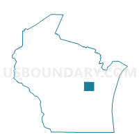
Outline

Summary
| Unique Area Identifier | 695948 |
| Name | LIBERTY - T 1 Voting District |
| County | Outagamie County |
| State | Wisconsin |
| Area (square miles) | 30.71 |
| Land Area (square miles) | 29.39 |
| Water Area (square miles) | 1.32 |
| % of Land Area | 95.70 |
| % of Water Area | 4.30 |
| Latitude of the Internal Point | 44.41572210 |
| Longtitude of the Internal Point | -88.65288790 |
Maps


Graphs
Select a template below for downloading or customizing gragh for LIBERTY - T 1 Voting District, Outagamie County, Wisconsin


Neighbors
Neighoring Voting District (by Name) Neighboring Voting District on the Map
- BOVINA - T 1 Voting District, Outagamie County, WI
- DEER CREEK - T 1 Voting District, Outagamie County, WI
- ELLINGTON - T 2 Voting District, Outagamie County, WI
- ELLINGTON - T 3 Voting District, Outagamie County, WI
- HORTONIA - T 1 Voting District, Outagamie County, WI
- MAINE - T 1 Voting District, Outagamie County, WI
- MAPLE CREEK - T 1 Voting District, Outagamie County, WI
- New London - C 1 Voting District, Outagamie County, WI
Top 10 Neighboring County Subdivision (by Population) Neighboring County Subdivision on the Map
- Ellington town, Outagamie County, WI (2,758)
- New London city, Outagamie County, WI (1,610)
- Bovina town, Outagamie County, WI (1,145)
- Hortonia town, Outagamie County, WI (1,097)
- Liberty town, Outagamie County, WI (867)
- Maine town, Outagamie County, WI (866)
- Deer Creek town, Outagamie County, WI (637)
- Maple Creek town, Outagamie County, WI (619)
Top 10 Neighboring Place (by Population) Neighboring Place on the Map
Top 10 Neighboring Unified School District (by Population) Neighboring Unified School District on the Map
- Hortonville School District, WI (18,952)
- New London School District, WI (16,079)
- Clintonville School District, WI (9,939)
- Shiocton School District, WI (4,207)
Top 10 Neighboring State Legislative District Lower Chamber (by Population) Neighboring State Legislative District Lower Chamber on the Map
Top 10 Neighboring State Legislative District Upper Chamber (by Population) Neighboring State Legislative District Upper Chamber on the Map
Top 10 Neighboring 111th Congressional District (by Population) Neighboring 111th Congressional District on the Map
Top 10 Neighboring Census Tract (by Population) Neighboring Census Tract on the Map
- Census Tract 128, Outagamie County, WI (7,399)
- Census Tract 127, Outagamie County, WI (6,282)
- Census Tract 132, Outagamie County, WI (3,949)